This assignment used ERDAS Imagine and ArcGIS Online to take a .img file and create a thematic map based on land cover. I need to work on cartography - I have ended up being short on time for several of these and the final product is not great.
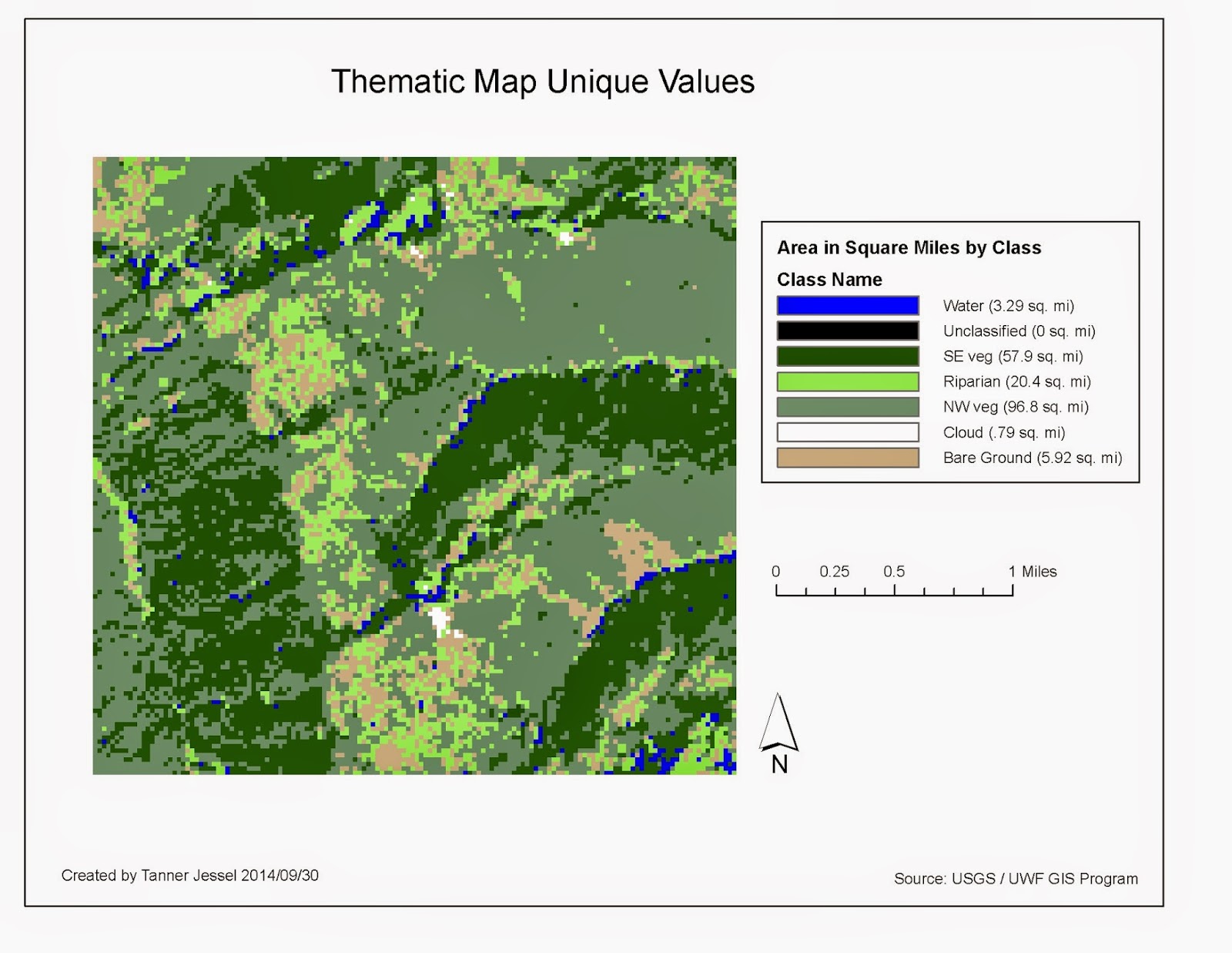 |
| Lab 05 Map: Thematic Map with Unique Values. |
For this lab, I sunk a bit of time into trying to add the table data for area covered. This would be a dynamic way of displaying data. I did not really want it to be appended to the legend. The table would have gone in the spot where I placed the scale bar.
I "hid" attribute columns so I only had square miles and the value, but I was not able to get the table data to display only those with values greater than 0. I was able to select them, but could not "hide" the other rows that did not have data, so I ended up with table data and a bunch of rows. I'd like to figure out how to fix that, but ran out of time to submit the assignment.
No comments:
Post a Comment